

AI for Disaster Management & Relief
Edier Aristizábal
Departamento de Geociencias y Medio Ambiente, Universidad Nacional, Medellín, Colombia

Disasters

Cause?
Disasters

Weather and climate-related disasters
Floods
Floods impact more people worldwide than any other disaster, and the economic, social, and environmental impacts are getting worse.
Hurricanes
Climate change is increasing ocean and atmospheric temperatures and increasing the frequency, duration, and intensity of hurricanes.

Landslides
By altering precipitation patterns, leading to more intense rainfall events that saturate soil and increase runoff.

Wildfires
Climate change intensifying, hotter temperatures, more intense and longer dry seasons.

The number of weather, climate and water extremes are increasing and will become more frequent and severe in many parts of the world as a result of climate change.
Cascade hazards & Multi-risk scenarios


50%
Weather & climate-related hazards
From 1970 to 2019, weather, climate and water hazards accounted for 50% of all disasters.
x5
Number of disasters
It has increased by a factor of five over the 50-year period, driven by climate change and improved reporting.
45%
Deaths & economic losses
45% of all reported deaths and 74% of all reported economic losses.
91%
Deaths
More than 91% of disaster casualties occurred in developing countries.
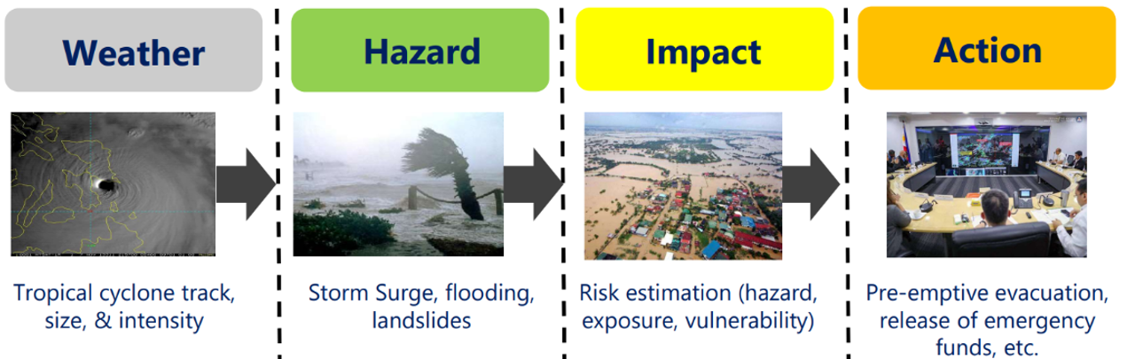
Risk management framework

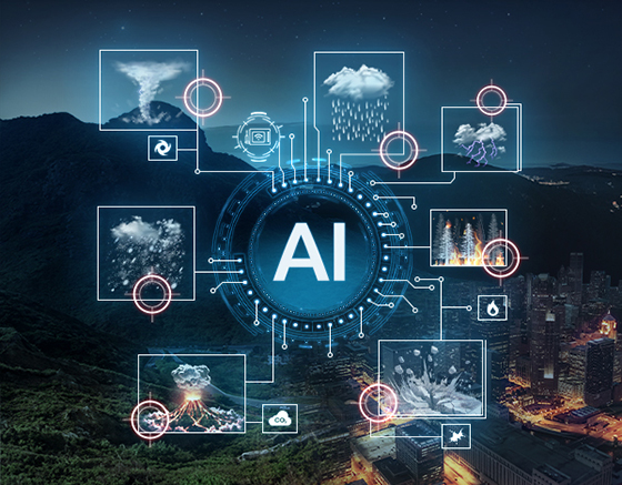
Applications of AI in disaster management

-
01
AI for data: monitoring and detecting
There are new opportunities for AI in Space and related technologies that can also have an actual application in disaster risk detection, analysis and then reduction.
-
02
AI for modelling: forecasting, and projecting
AI helps accelerate data acquisition and analysis, taking into account the spectrum of heterogeneity owned by each natural hazard and situations.
-
03
AI for communication
AI’s deployment is at the utmost priority to enhance the understanding of all phases of disasters, and this can be done by accelerating the development of algorithms that are reliable for our safety.
AI Tools and Example Uses
| Tools | Description | Examples of Commercial Systems | Uses in Emergency & Disaster Management |
|---|---|---|---|
| Predictive Analytics | Finds patterns in data and forecasts future outcomes. | Salesforce | Risk modeling; disease outbreak spread prediction; flood/wildfire spread prediction; dashboards and situational awareness |
| Generative AI and Natural Language Processing | Understands and translates human language and creates new text, images, or video | ChatGPT, Claude, DALL·E | Drafting emergency communication templates; creating scenarios for training; Multilingual crisis communication; rumor detection |
| Robotics & Automation | Performs physical tasks with or without human control, including operating vehicles. | iRobot Roomba, Da Vinci Surgical System; Boston Dynamics robots; Waymo | Search-and-rescue in dangerous areas; supply delivery; debris clearing |
| Computer Vision | Identifies and interprets objects, people, and activities images/video. | Google Photos, Clearview AI; Tesla Autopilot | Damage assessment via drones/satellites; search-and-rescue; wildfire smoke mapping |
| Speech Recognition & Generation | Converts speech to text and produces human-like speech from text. | Siri, Alexa | Voice-to-text for field reporting; hands free operations |
| Recommendation Systems | Suggests products, content, or actions based on user behavior. | Netflix, Spotify, Amazon | Resource allocation; shelter options; individual risk alerts |
| Fraud Detection & Security | Identifies anomalies to call attention to risks. | Mastercard AI Security, Darktrace, PayPal | Detecting fraud in payments; cybersecurity |
The AI in Disaster Risk Market

Risk Intervention Matrix
AI & Remote sensing data
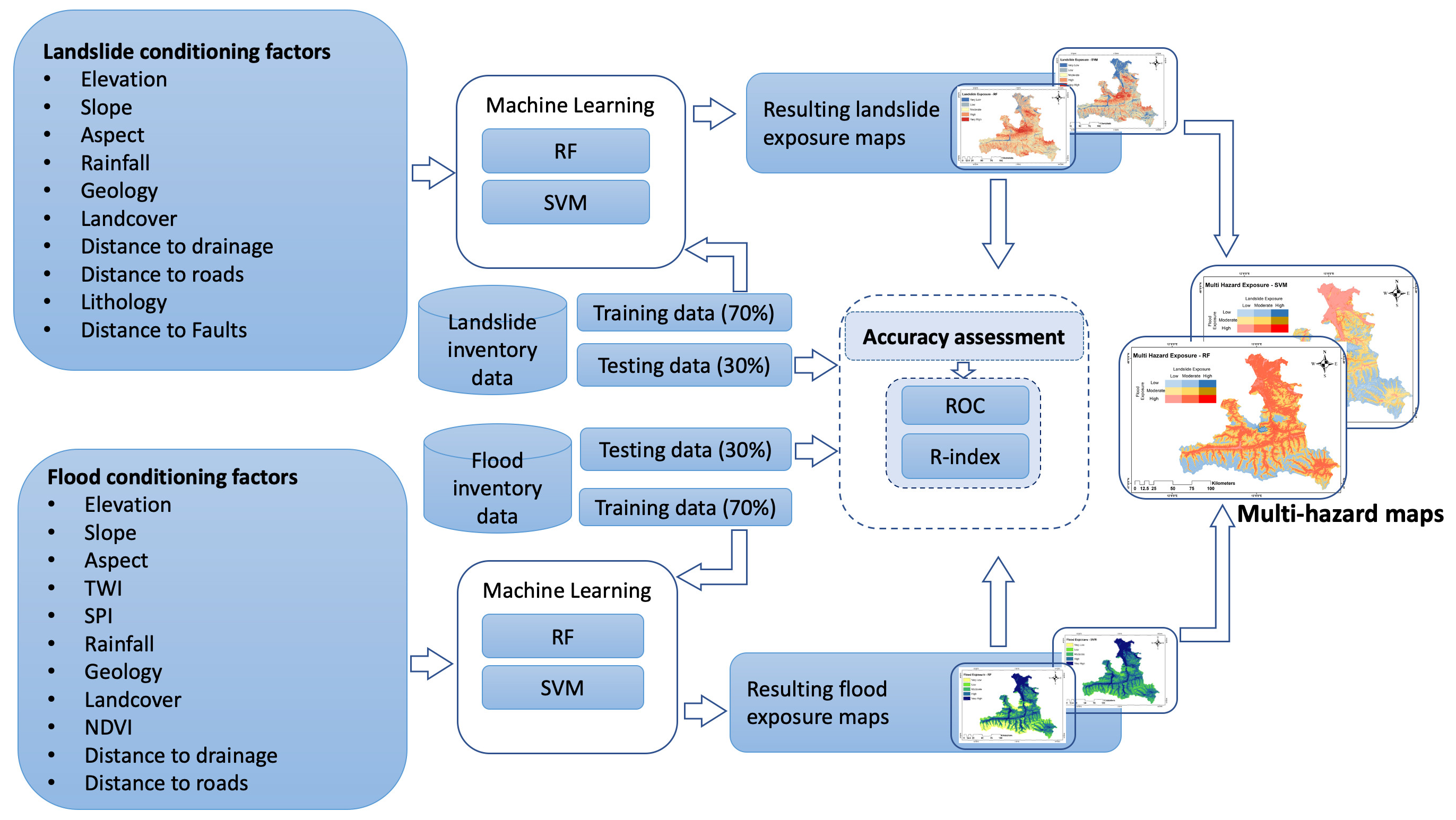
AI has the potential to speed up our understanding of natural hazards, analysing large volumes of data (and images) from different sources and improve proactive rather than reactive actions for disaster risk reduction (DRR).

Landslide mapping

Machine learning techniques
Land use planning

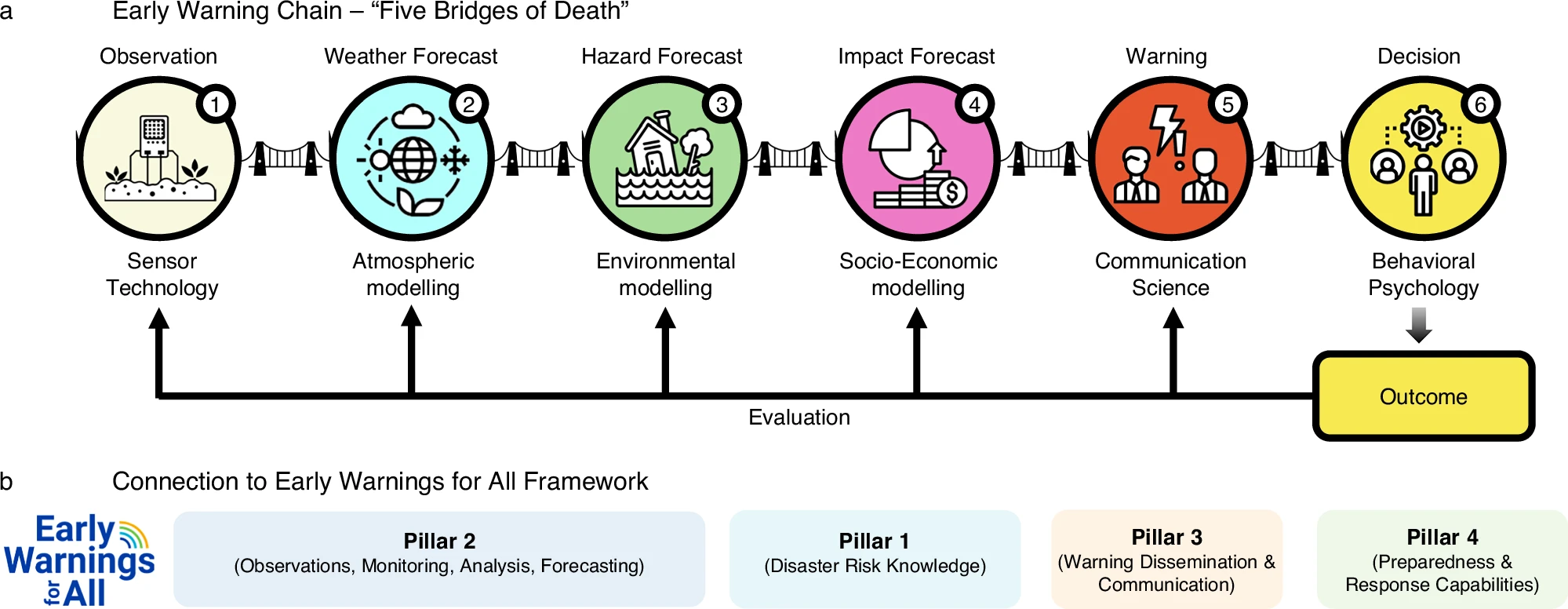
Early warning systems
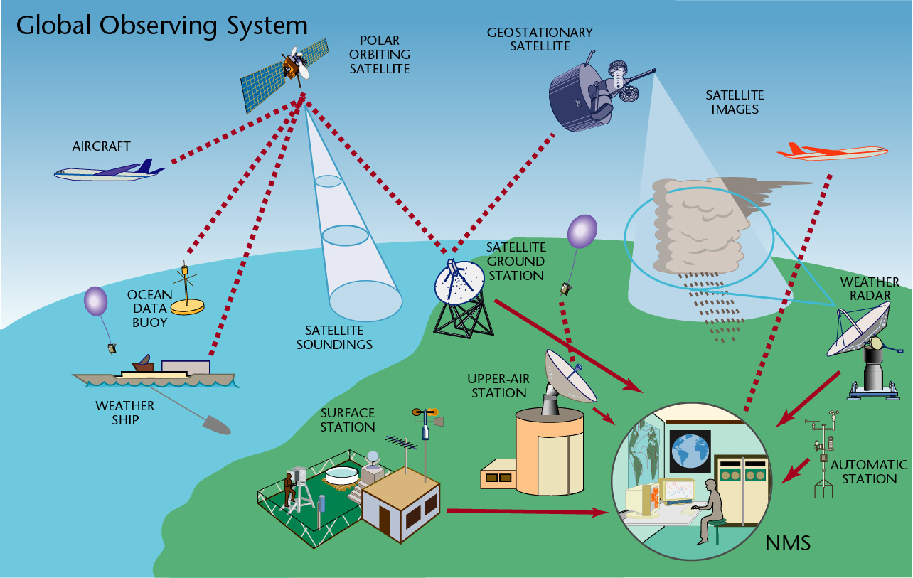
Global Observing System
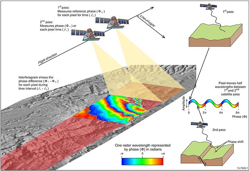
Interferometric Synthetic Aperture Radar (InSAR)
Effectiveness of communication

Impact-based forecast and warnings
Damage and strategize rescue efforts

¡Gracias!
https://edieraristizabal.github.io/Presentaciones/AIclimate_Disaster.html
evaristizabalg@unal.edu.co